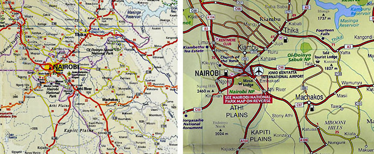
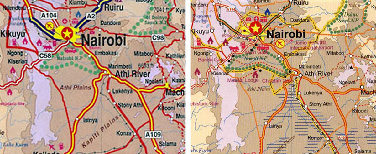
Although we depended on Micato Safaris for our itinerary in Kenya, that did not dampen my enthusiasm for acquiring maps both there and prior to our departure. Not needing a map for navigation is irrelevant to someone (like me) who may only be using travel as an excuse to buy more maps.
The simplest advice regarding maps of Kenya is that you shouldn’t depend on any particular one, so expect to do some cross-referencing to get a complete picture.
The Globetrotter Travel Map for Kenya (available on Amazon) has the advantage of including detail maps of several of the national parks. The Rough Guide (aka “Reise Know-How World Mapping Project”) Kenya map is durable, beautiful, and uncluttered, in part owing to a hypsometry scheme which is so subtle as to be almost nonexistent. If you aren’t too concerned about elevation changes, both of these companies provide an attractive product.
My usual favorite map source, ITMB, produced a Kenya map (Scale 1:2,800,000) in 2001 that used topography colors and lines which made it more useful – but it is apparently no longer in print. They listed their current (?) version (1:920,000) as “almost out of stock” in September 2010, and the Omnimap catalog shows another ITMB Kenya map (1:1,400,000) which ITMB has either discontinued or neglected to include on their own website.
Nairobi city maps were easy to obtain after arrival, and the publisher – Tourist Maps Kenya – may also have the best maps of the national parks. However, if they provide overseas shipping service for online orders it is not immediately apparent on their website. Omnimap offers most, if not all, of their series of maps.
Online maps are numerous, and the Kenya Association of Tour Operators (KATO) offers a good, though not interactive, example. Many or most of the online interactive maps have a commercial affiliation, which means they may only feature the attractions and accommodations of their partners or subscribers.
The common characteristic of Kenya maps is that although they indicate the names and locations of attractions, accommodations, geographic features, etc., no map seems to be in complete agreement with any other. Also, you can find the names of camps, lodges, hotels, and other tourist facilities for which there is not a single mention anywhere on the internet. The ownership and economic fortunes of the various properties are in constant flux, but regardless of the reason for the ambiguities it is probably best to avoid reliance on any one source.
The most exhaustive collection of information regarding the parks and conservation areas of Kenya, the Kenya Wildlife Service website, does not provide or recommend any maps, in either paper or electronic form. Perhaps this is the best of all indications that choosing a really good map of Kenya is more art than science.
(A more general discussion of my love affair with maps can be found at the The Travel Chronicle Travel Map page.)
[hana-code-insert name=’Bottom Inline Links’ /]


If you would like to comment on this page, please use the form directly below.
To post a new topic, or submit your own photos, use the “Click here for Comments” link at the bottom of the page, and read the first post.